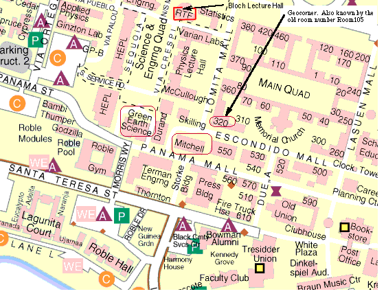
Location: Stanford University
This will be the 414th meeting since 1954
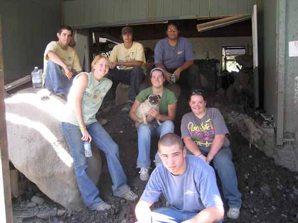
Eastern Sierra Youth Conservation Corps members take a break for a group photo: (from left) Whitney Pate, Ronnie Stockman, Roy Orihuela, Equal Kennedy, Bonnie Brown, Joe Blumberg and Kayla Nauman (from BLM-Calfornia News Bytes)
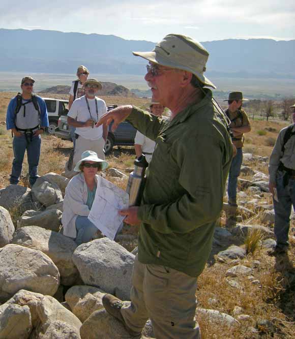
On July 12, 2008 the remains of hurricane Bertha moved from the Gulf of Mexico across the southwestern United States bringing tropical moisture to the eastern Sierra Nevada. Over 32 mm/hr (1.25 in/hr) of precipitation fell on the Oak Creek drainage north of Independence, in Inyo County, California, which had been burned during the Inyo Complex fire of July 6, 2007, generating debris and mudflows that ran out 6 to 7 km from the mountain front, destroying 25 homes, damaging another 25, severely damaging the historic Mt. Whitney Fish Hatchery, and disrupting traffic on State Highway 395 for nearly a week. Although slopes were extensively rilled, most of the estimated 1.53 million cubic meters of sediment was scoured from channels and deposited over an area of more than 3 km2, mostly on younger alluvial fans. Mudflow surges moved down the north fork of Oak Creek at estimated speeds of 2 m/sec (~6 m/hr) to 5.4 m/sec (~16 m/hr) and were one to three meters high. Sand-rich, hyperconcentrated mudflows followed the active channel of the north fork of Oak Creek and abandoned channels on the fan filling them, and spread laterally across the interfluves. On the south fork of Oak Creek, boulder-rich debris flows clogged the active channel, leaving a boulder field of at least 1500 m long and 75 m wide, blocking the channel and forcing the south fork to a new course to the west. The largest boulders moved during the storm ranged from 3300 kg (~1300 lbs) to 17,000 kg (11,800 lbs). Nearly all the damage to private property and infrastructure was long the active stream channels where the hazard is the highest. Older uplifted alluvial fans were unaffected and are the least hazardous areas, while younger fans were greatly affected and should be considered, for the most part, highly hazardous. Mitigation strategy should emphasize avoidance and education to promote public awareness.
Dave Wagner
Dave Wagner is a geologist with the California Geological Survey (CGS), currently residing in the Owens Valley. Most of his career has been spent conducting regional geologic mapping, but he has investigated the 1983 debris flows in western Marin County, the American River Canyon landslide that closed Highway 50 in 1997, and the 2008 Oak Creek debris flows in Owens Valley.
Reservations: The preferred way to make reservations is simply to email John Spritzer at jspritzer@usgs.gov by March 5, tell him you will attend, commit to pay, and bring your payment to the meeting. John always emails a confirmation; if you don’t get one, assume email crashed yet again and email him a second time. A check made to “PGS” is preferred, payable at the meeting.
If you want to pay in advance:
Everyone (including Stanford folks now) Please make dinner reservations by April 9. Contact John Spritzer, at U.S. Geological Survey, 345 Middlefield Road, MS-973 Menlo Park, CA 94025, Tel.: (650) 329-4833. Send check made out to “PGS” to John.
Dinner is $35.00. Includes wine (5:30 to 6:15 PM.) and dinner (6:15-7:30 PM.).
For students from all universities and colleges, the dinner, including the social 3/4-hour, is $8.00 and is partially subsidized thanks to the School of Earth Sciences, Stanford University (Note, no-show reservations owe the full price).
Doris, whose wonderful crew prepares our meals, asked that we let you know that people who are late RSVPing and people who show up without a reservation will be welcome but that they will be eating on paper plates with plastic utensils (food supply permitting).
Dues for Academic Year 2009-2010 ($10.00) should be sent to John Spritzer, U.S. Geological Survey, 345 Middlefield Road, MS-973 _Menlo Park, CA 94025. John’s phone: (650) 329-4833.
Officers: Vicki Langenheim, President; Jon Hagstrum, Vice President; Mike Diggles, Secretary; John Spritzer, Treasurer; Elizabeth Miller, PGS Stanford University Coordinator
Date created: March 19, 2010
Last modified: March 19, 2010
Created by: Mike Diggles, Webmaster-Secretary, PGS.